Mushroom maps · prediction
Pine porcini map
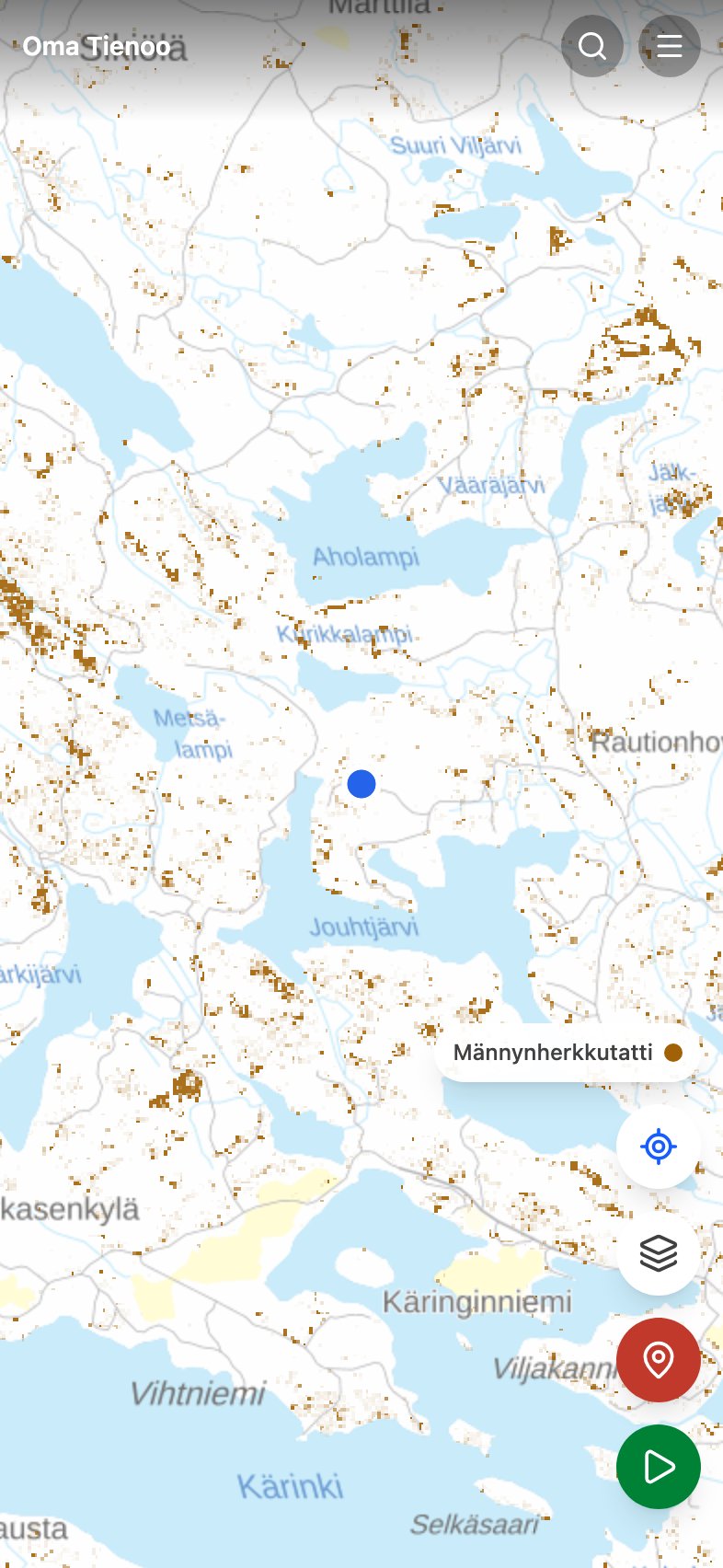
Männynherkkutatti, the pine porcini (Boletus pinophilus), is a bolete of dry heath: heathery, lichen-carpeted pine terrain and old, open stands. It shares a name with the porcini and grows in a completely different forest.
The map does not claim mushrooms are growing here right now. It colors, across the whole country, the forest stands where the pine porcini thrives, in other words where it is worth walking. The weather decides the harvest, and the app now says so: Painota sään ja kauden mukaan dims the layer where the species is out of season or where the rain has not come. The color still means terrain, not a crop.
What kind of forest the pine porcini seeks
- Trees
- A companion of pine: a pure pine stand is best, and the more spruce or broadleaf there is, the weaker the prediction.
- Site type
- Kuivahko kangas (dryish heath forest) is best, dry heath nearly as good. Tuore kangas (mesic heath forest) is already at half strength, and barren heath is weak.
- Ground
- Kangasmaa (mineral-soil forest). Even a pine stand on a räme (pine bog) can do; a korpi (spruce mire) is not its terrain.
- Stand age
- A pine stand around 50 to 100 years old; in very old stands the prediction declines slowly.
- Season
- July to September.
- Northern limit
- Holds out north best of all six: still over half the southern level at latitude 66.5.
The bars say whether a species is worth looking for now in the southern, central or northern part of the country. The division is the Finnish Meteorological Institute's. How the season and the weather are worked out
How to read it
Look at eskers and their slopes, heather and patches of reindeer lichen. The model favors open stands, so a dense sapling stand or a planted pine field is not the place.
Identification and cooking notes: the herkkutatti boletes at Martat (in Finnish).
What the prediction is computed from
The base is the multi-source national forest inventory map data (MVMI 2023) from Natural Resources Institute Finland: tree species shares, site fertility, mire type, stand age, volume and canopy cover in 16-meter cells across the whole country. Each row above is one factor in the model, and the factors are multiplied together, so one clearly wrong factor is enough to zero out a cell. Toward the north the prediction is damped according to observation counts from GBIF and Laji.fi, so that sparse recording in the north does not read as the species being absent. More: the mushroom maps and their limits.