Mushroom maps · prediction
Curry milkcap map
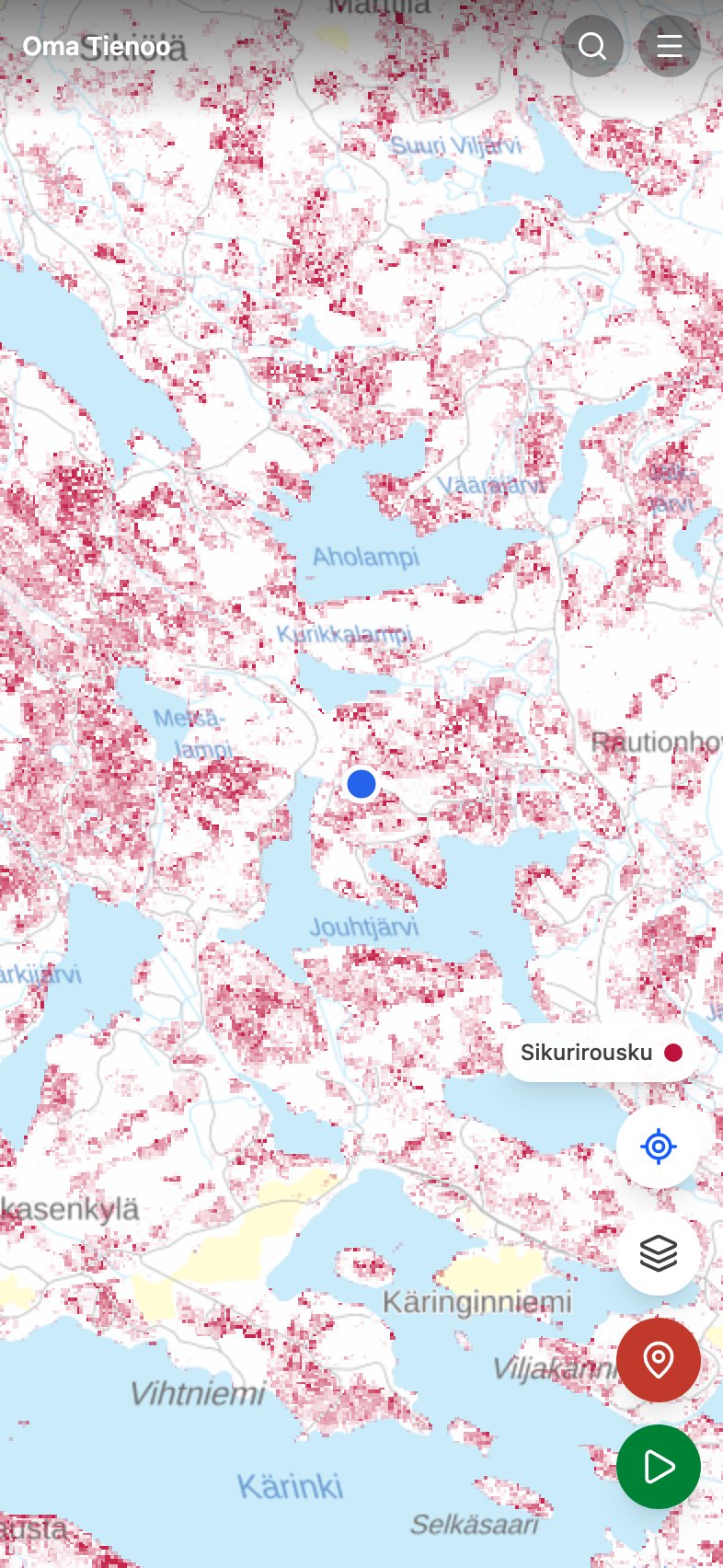
Sikurirousku, the curry milkcap (Lactarius camphoratus), is a spice mushroom that grows with spruce in moist, mossy conifer forests. The species is common in southern and central Finland and grows rarer toward the north.
The map does not claim mushrooms are growing here right now. It colors, across the whole country, the forest stands where the curry milkcap thrives, in other words where it is worth walking. The weather decides the harvest, and the app now says so: Painota sään ja kauden mukaan dims the layer where the species is out of season or where the rain has not come. The color still means terrain, not a crop.
What kind of forest the curry milkcap seeks
- Trees
- A companion of spruce: grows in mossy spruce stands and mixed conifer forests with some pine in them.
- Site type
- Tuore kangas (mesic heath forest) is best, kuivahko kangas (dryish heath forest) good, and lehtomainen kangas (rich heath forest) will do.
- Ground
- Kangasmaa (mineral-soil forest), but a korpi (spruce mire) and a räme (pine bog) work too: korpi hollows are good terrain.
- Stand age
- Stands around 55 to 120 years old.
- Season
- August to October.
- Northern limit
- The prediction declines after latitude 63 and collapses to nearly zero at 66.
The bars say whether a species is worth looking for now in the southern, central or northern part of the country. The division is the Finnish Meteorological Institute's. How the season and the weather are worked out
How to read it
The curry milkcap is mild and needs no parboiling. Dried, its scent recalls curry and caraway. Its patches on the map are large because the terrain is common: use it for planning an outing rather than for pinpointing a single spot.
Identification and cooking notes: sikurirousku at Martat (in Finnish).
What the prediction is computed from
The base is the multi-source national forest inventory map data (MVMI 2023) from Natural Resources Institute Finland: tree species shares, site fertility, mire type, stand age, volume and canopy cover in 16-meter cells across the whole country. Each row above is one factor in the model, and the factors are multiplied together, so one clearly wrong factor is enough to zero out a cell. Toward the north the prediction is damped according to observation counts from GBIF and Laji.fi, so that sparse recording in the north does not read as the species being absent. More: the mushroom maps and their limits.